|
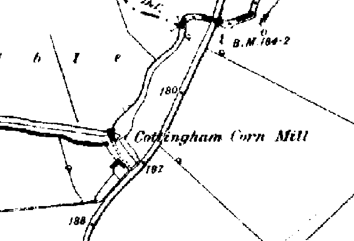
As shown on the 1887 OS map opposite, there used to be a water
mill located on the diverted course of the River Welland off
Mill Road.
The
Domesday Book of 1085 recorded a mill in
Cottingham. In all probability, this referred to a water mill, but it is
unlikely that it was in the same position as the 1887 mill because the original line of the
river at this time was further north (along the county boundary).
Around
1539, Cotingeham
was recorded as having
three mills - one horse drawn, one watermill and one
windmill.
In medieval times, all
three mills would have come under the monopoly of the
Lord of the Manor. and the villagers would
have been liable to heavy fines if they took their corn elsewhere to be
ground.
Cottingham water mill
dates back to at least 1705 when the miller was John Richardson.
Subsequent millers recorded are John Robinson (1773), Samuel Burdett
(1779), W Aldwinckle (1856), Bartholomew Aldwinckle (1890) and JH
Aldwinckle (1890).
In the late 19th Century, a
Mr Shrive took tenancy of the mill and combined farming, corn grinding and
eel catching. The mill had an eel trap and the Mr Shrive sent the eels to
Billingsgate!
By 1922, the mill was
disused. It was
seriously damaged by fire
in the Summer of 1936 and subsequently demolished. It is rumoured that the
mill was set alight by a candle placed on a heap of straw.
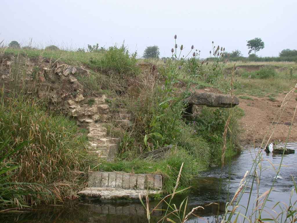
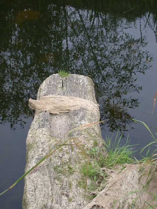
The mill itself would have
sat astride the river which has been diverted to form a straight mill race,
with a 6 foot (3 metre) tall mill wheel attached to the south bank. Little
remains of the mill now but the part stone and part timber 'cill' (at the
base of the wheel) can still be seen, as can some of the mill's stone and
brick foundations.
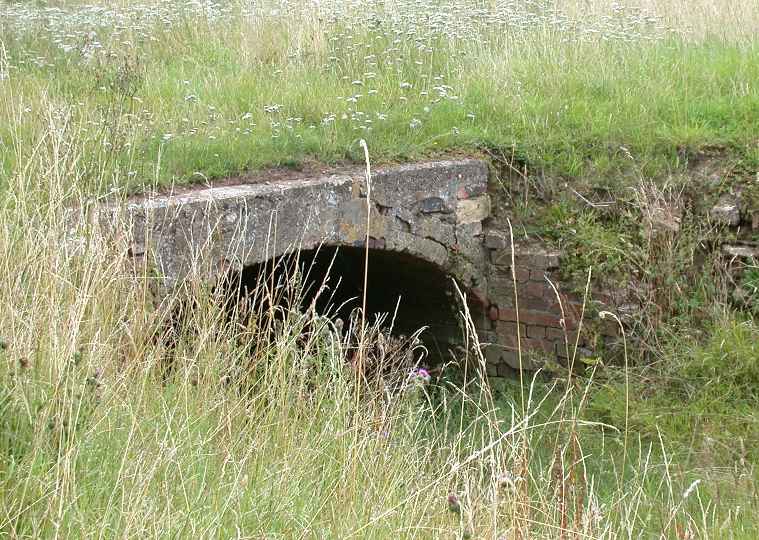
There was also a spillway
(overflow) that carried water around the mill if water levels became too
high. The brick arched bridge that crossed this spillway can still be
seen.
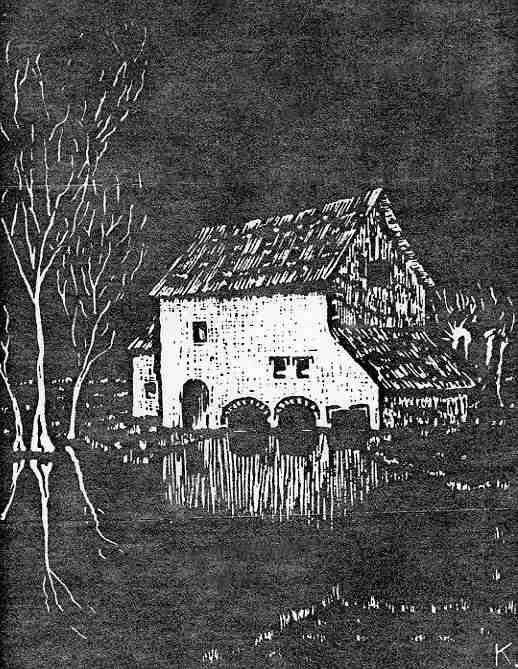
The linoleum block picture
of the mill opposite was created by local school headmaster Allston Kisby
and was featured in the Northants County Magazine.


Remains of the cill for the millwheel
(South
riverbank)
With thanks to Keith
Allsop for his help with information on the mill.
|